This content was published: May 29, 2025. Phone numbers, email addresses, and other information may have changed.
Geographic Information Systems incorporates StoryMaps software in learning and partnerships
Story by Misty Bouse
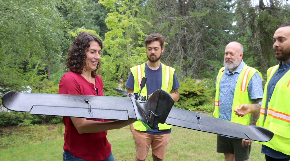
GIS faculty Christina Friedle shows off the latest fixed-wing drone for mapping.
Storytelling and mapping seem to go hand in hand these days.
As a growing career field with cross-industry demand, the fields of geographic information systems (GIS) and small unoccupied aircraft systems (UAS), or known as drones, are playing a transformative role in education. Portland Community College is capitalizing on interest in the field by integrating GIS into K-12 classrooms, equipping students with real-world problem-solving skills.
In August of 2024, PCC’s GIS Program led its second week-long professional development workshop for local educators using StoryMaps, ArcGIS Online and Survey 123, all interactive mapping tools from Esri. Because today’s students will shape tomorrow’s solutions, Esri offers free resources for K-12 educators that turn geographic data into interactive maps, stories and insights. By exploring spatial relationships and patterns, students develop critical thinking and analytical skills.
GIS is increasingly being used beyond STEM subjects, helping students visualize data and make informed decisions across various disciplines.
Bringing Data to Life
StoryMaps is an accessible entry point into Esri’s suite of GIS products, allowing users to map and present information in an engaging format. It enables students to collaborate, integrate location-based data into projects, identify patterns and share their findings. StoryMaps has become a valuable resource in classrooms.
Teachers are using StoryMaps to design interactive assignments that enhance learning. At an area high school, an English teacher created the “Mapping Who I Am” project, where students introduce themselves through interactive maps. Using ArcGIS Online, students highlight meaningful locations, incorporating images and videos to express their interests. This project aligns with English Language Arts and Literacy standards, fostering digital literacy and engagement.
In recent years, PCC has expanded GIS learning opportunities and outreach efforts, including degrees and certificates.
At McDaniel High School in Northeast Portland, teachers collaborated with PCC’s GIS team to incorporate UAS technology, mapping their campus to optimize sustainable plantings for agricultural studies. In January, McDaniel students visited the Sylvania Campus on a field trip to learn more about GIS applications and the program firsthand. The students visited the GIS lab and also toured the campus’ learning garden. Learning about drones and GIS complements the high school’s career technical education program of engineering and computer science and STEM offerings, said Christina Friedle, geography instructor and GIS Program lead.
Expanding Learning Opportunities
Beyond K-12 education, PCC faculty and staff across disciplines, including art, science, business, and even the grants office, are integrating GIS into coursework and research. Students apply GIS technology to projects such as climate change modeling, market analysis and land-use planning.
“GIS and other Geospatial Technologies equip students with valuable technical and analytical skills that are highly sought after in today’s job market,” Friedle said.
Thanks to past National Science Foundation funding, PCC has expanded GIS learning opportunities and outreach efforts, including developing a Geomatics degree, a Geospatial UAS Certificate and internship funding. Alumni of the program also share with visiting middle and high school students of how useful geospatial technologies are in building and construction and other real world applications.
“We’re preparing the next generation of geospatial technicians and land surveyors,” Friedle said. “Our goal is to close the industry’s skills gap and bring more professionals into this high-demand field.”
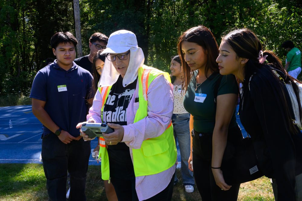
At an event in 2024, GIS faculty demonstrated drone technology to students from the Latino Network, broadening the appeal of the skills and tools.
A High-Demand Career Path
Once a specialized tool, GIS is now an essential technology across numerous industries. It plays a critical role in utilities, construction, aerospace and defense, transportation, logistics, agriculture, mining, oil and gas, government, and more. As organizations increasingly rely on spatial analysis for decision-making, GIS professionals are in high demand.
PCC students are gaining hands-on experience through research projects and internships, working with local agencies and businesses to address community challenges. Recent projects have included mapping flood-prone areas, analyzing traffic patterns, and assessing the impact of green spaces on urban development.
To support the growing interest in GIS, PCC has expanded access to training and software. The college offers faculty-led workshops and specialized training sessions, in the dedicated GIS lab equipped with advanced spatial analysis tools.
As industries continue to embrace GIS for environmental management, public health and urban planning, PCC is positioning students for success in an increasingly data-driven world.
GIS Collaborations
- In December, an interdisciplinary art exhibition at the Sylvania Campus North View Gallery explored graffiti mapping and research in Rio de Janeiro, New Orleans and Portland. The work was conducted by GIS students.
- Instructor Lorena Nascimento and academic advisor Cherise Frehner utilized GIS mapping tools to research and explore the prevalent themes and locations of the graffiti art found in Portland neighborhoods.
- Last summer, PCC Grants Officer Beth Gebstadt partnered with the GIS instructor Angela D’Esposito to utilize StoryMaps to illustrate the distribution and impact of the college’s districtwide grants in 2023 highlighting faculty and collaborative efforts.
For more information, visit pcc.edu/programs/gis.
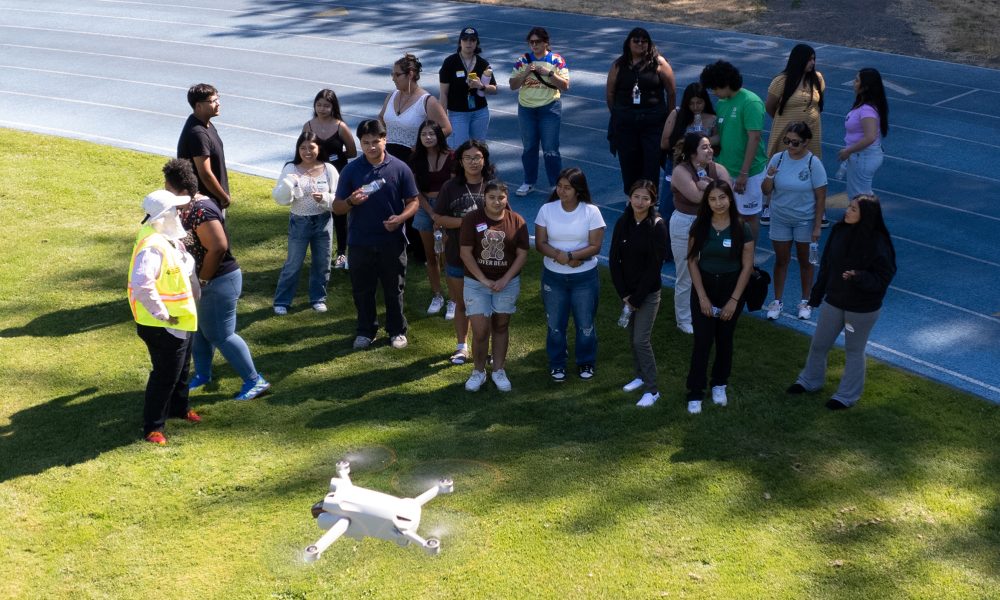
GIS collaboration with community groups have been ongoing.
About Misty Bouse
A Portland Community College public relations specialist, Misty Bouse has been working in college advancement for a decade. A graduate of University of Oregon, Misty has worked as a managing editor for BUILDERNews Magazine and as a contribu... more »